An integrated, evidence-based approach to Uganda's land
Sustainable Land Management (SLM) in Uganda is an integrated, knowledge- and evidence-based approach to managing the country's natural resources — land, soil, water, vegetation and biodiversity — in ways that maintain or restore land productivity, prevent and reverse land degradation, sustain ecosystem services, strengthen resilience to climate and other production risks, and improve the livelihoods and food, nutrition and income security of land users.
SLM recognises that soil, water, vegetation, biodiversity, climate and people are closely connected. When these resources are well managed, agricultural land remains productive, ecosystems remain healthy, and communities become more resilient to climate change and other shocks. To sum it up: SLM is about managing our land today for a productive tomorrow.
Read more about SLM's institutional home and technical work ›
Key message
SLM is not simply about protecting the environment. It is about keeping land productive, improving livelihoods, and ensuring that Uganda's natural resources continue to support development for generations to come.
What happens when land degrades
Uganda's economy and livelihoods depend heavily on agriculture and natural resources. Yet many parts of the country are experiencing soil erosion and nutrient mining, leading to declining soil fertility, loss of vegetation, deforestation, wetland degradation, overgrazing and increasing climate-related risks. Left unaddressed, land degradation results in:
Lower productivity
Declining crop and livestock productivity as soils lose their capacity to support growth.
Lost topsoil & nutrients
Fertile topsoil and nutrients washed or blown away, reducing what the land can yield.
Water stress
Reduced water availability and poorer water quality for crops, livestock and people.
Climate vulnerability
Increased vulnerability to droughts and floods as landscapes lose their natural buffering.
Biodiversity loss
Loss of biodiversity and the ecosystem services it provides — pollination, pest control, stability.
Falling incomes
Declining household incomes and food security as the land beneath them weakens.
SLM provides a way of addressing these challenges while maintaining agricultural production and productivity.
SLM connects soil, water, vegetation and people
A healthy landscape functions as a connected system. When one part is degraded, the effects spread across the landscape — removing vegetation, for example, can increase soil erosion, reduce water infiltration and eventually lower agricultural productivity. SLM means managing these resources together, not treating soil, water, vegetation and biodiversity as separate issues.
Healthy soils
Provide nutrients and support crop growth.
Vegetation cover
Protects soil from erosion and helps retain water.
Healthy water systems
Support crops, livestock, people and ecosystems.
Biodiversity
Contributes to pollination, natural pest control and ecosystem stability.
Resilient landscapes
Better able to withstand droughts, floods and changing climatic conditions.
Productive land
Supports food security, incomes and livelihoods.
The scale of the challenge
Uganda has a total area of 241,551 km². The Uganda Forest Landscape Restoration Opportunity Assessment found that a substantial share of this land is already degraded to some degree.
IUCN (2016), Uganda Forest Landscape Restoration Opportunity Assessment. Only 5.8% of land is classified as having low degradation.
| SLM hotspot | Main characteristics & degradation concerns |
|---|---|
| Lake Victoria Crescent / Basin | High population density, intensive cultivation, deforestation, wetland loss and continuous cultivation; intense rainfall contributes to soil erosion and climate-induced degradation. |
| Southwestern & Eastern Highlands | High population pressure, land scarcity and fragmentation, cultivation on steep/fragile terrain, declining fallow periods and serious soil erosion. |
| Eastern & Northern Uganda | Nutrient depletion, agricultural intensification, reduced fallow periods, deforestation, wetland drainage and increasing pressure on land resources. |
| Drylands / Cattle Corridor | Erratic rainfall, recurrent drought, overgrazing, bush burning, deforestation, shortened fallows and relatively low adoption of SLM practices; vulnerability to desertification and climate variability. |
USIF-SLM (2010). Hotspots identified from the interaction of biophysical and socio-economic factors: topography, rainfall, soil erodibility, land cover, population pressure, poverty, land-use intensity, land tenure and access to markets.
Who delivers SLM in Uganda
SLM in Uganda is implemented through a multi-institutional framework involving government ministries and agencies, research institutions, universities, development partners, civil society and non-governmental organisations.
MAAIF
The Ministry of Agriculture, Animal Industry and Fisheries provides the overarching policy and institutional framework for agricultural land management, and supports coordination, planning and implementation of SLM-related programmes.
NARO
Through its research institutes — particularly the National Agricultural Research Laboratories (NARL)–Kawanda and its Soils, Environment and Agro-meteorology Unit — NARO provides scientific and technical expertise for SLM research, assessment, technology development and validation, land-resource characterisation and information generation.
NARO's mandate
Established by an Act of Parliament enacted on 21 November 2005, NARO is Uganda's apex public institution responsible for guiding and coordinating agricultural research nationally. Its vision is a farmer-responsive research system that generates and disseminates problem-solving, profitable and environmentally sound technologies, knowledge and information on a sustainable basis. Its mission is to generate, promote adoption of, and disseminate appropriate, demand-driven agricultural technologies, knowledge and information through an effective, efficient, sustainable, decentralised and well-coordinated agricultural research system — enhancing agricultural research's contribution to sustainable productivity, economic growth, food security and poverty eradication.
Public universities — including Makerere University, Kyambogo University and Busitema University — contribute through teaching, training, research, innovation and professional capacity development. NGOs, civil society organisations and development partners complement government and research institutions by supporting community mobilisation, demonstration and adoption of SLM technologies, capacity building, restoration activities and the scaling of proven practices. Local governments and communities are critical to implementation and sustainability at landscape and local levels.
Overall, Uganda's SLM institutional arrangement brings together policy and coordination, scientific research and technical support, education and capacity development, community engagement, and field-level implementation — each actor contributing according to its mandate and expertise.
Inside NARL–Kawanda's Soils, Environment & Agro-meteorology Programme
SLM work at the National Agricultural Research Laboratories (NARL)–Kawanda brings together knowledge, research, technologies and technical services relating to soils, land, water, climate and environmental management. Outputs are designed to benefit farmers, extension workers, government and local governments, planners, researchers, universities, students, environmental agencies, NGOs, private-sector enterprises and investors. Expand each area below for details.
Soil Health & Fertility Management
Assesses soil condition and fertility, and develops and validates approaches for maintaining and improving productive capacity — addressing nutrient deficiencies, soil acidity, declining organic matter and inefficient nutrient use. Activities include soil sampling and lab analysis, integrated nutrient management, evaluation of organic and inorganic nutrient sources, and fertiliser recommendation updates. Outputs: soil analytical services, technical advice, maps, technical reports and training materials.
Soil & Water Conservation
Develops, evaluates and promotes practices that reduce erosion, improve soil-water retention and increase efficient rainfall use — matching conservation measures to local conditions rather than treating one technology as suitable everywhere. Recent NARL training covered infiltration trenches, grass strips, hedgerows, soil bunds, Zai pits/permanent planting basins, rip lines, contour establishment, manure management, mulching and cover crops. Outputs: conservation technologies, erosion-control recommendations, degradation risk maps and soil quality assessments.
Soil Microbiology
Studies the diversity, functions and interactions of soil microorganisms in nutrient cycling, crop productivity and environmental quality — biological nitrogen fixation, organic matter decomposition, disease suppression and bio-fertiliser development. Outputs: microbial inoculants, bio-fertiliser technologies, technical guidelines and research publications.
Land-Use Planning & Natural-Resource Management
Integrates soil, terrain and climate information to support informed land-use and agricultural planning, helping decision-makers match land uses to their physical and environmental characteristics. Outputs: land-resource assessments, land capability information, soil-resource maps and decision-support information.
Soil Survey & Mapping
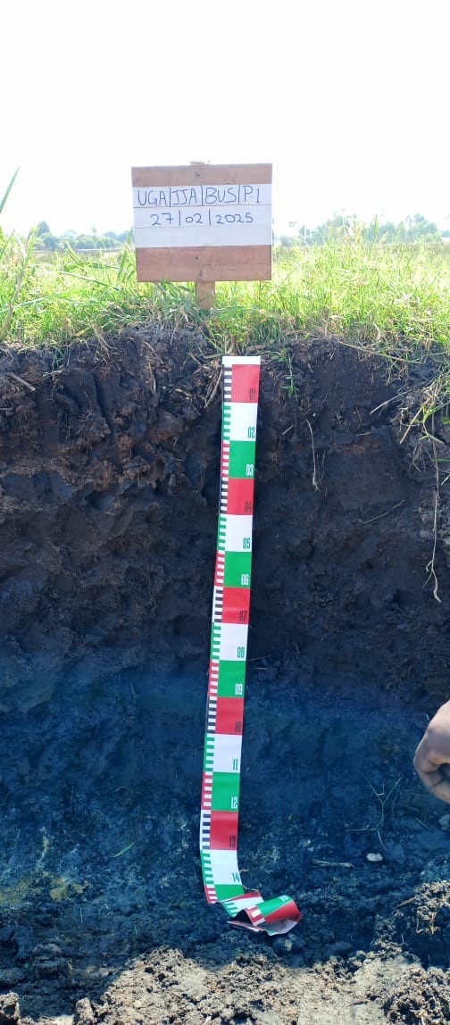
Conducts systematic soil surveys and resource assessments to understand the distribution, characteristics and limitations of Uganda's soils — from reconnaissance level to detailed client surveys. A key national activity under way is updating and digitising Uganda's soil map from 1:250,000 to 1:50,000 scale. Outputs: soil classification data, soil-property maps, land and crop suitability maps, and soil databases.
Agro-meteorology & Climate Science
Links weather and climate information to agricultural planning and management. NARO's Remote Telemetry Units collect real-time temperature, rainfall, wind speed and evaporation data across several agro-ecological zones, supporting research on climate variability, crop-water relationships and adaptation. Outputs: weather datasets, climate summaries, agricultural advisories, climate-smart technology packages and AEZ-specific recommendations.
This combination of expertise provides an important scientific foundation for evidence-based SLM planning, implementation and decision-making in Uganda.
Supporting infrastructure
National Soils & Plant Tissue Analytical Laboratory
Provides analytical services covering soil chemistry, soil physics, water quality and soil microbiology — essential information for understanding soil conditions and guiding fertility management and land-use decisions.
GIS Laboratory
Supports spatial analysis, soil and land resource mapping, land suitability assessment, environmental monitoring and landscape-level planning.
Connecting knowledge, institutions and practitioners
The SLM website serves as a national knowledge and information platform for Sustainable Land Management in Uganda, bringing together scientific knowledge, data, tools, technologies, good practices and experiences. It also links out to WOCAT (World Overview of Conservation Approaches and Technologies) and USIS (Uganda Soils Information System).
While NARL–Kawanda provides the institutional home and scientific leadership, SLM is inherently multi-sectoral: it requires collaboration among research and extension institutions, government ministries, local governments, universities, development partners, civil society, the private sector and farming communities. The platform aims to connect knowledge, institutions and practitioners to support informed decisions and wider adoption of SLM practices across Uganda.
At a glance
Institutional home: NARL – Kawanda
Parent organisation: NARO
Technical anchor: Soils, Environment & Agro-meteorology Unit
Platform role: National knowledge & information platform for SLM in Uganda
Four ways into the platform
Land & Soils
Soil mapping, land degradation information and spatial products, with guidance on how to read them.
View land & soil information ›SLM Technologies
A catalogue of practices — what problem each solves, where it works, and what it takes to implement.
Browse technologies ›Zones & Hotspots
Place-based profiles: farming systems, degradation pressure and the practices suited to each zone.
See zone profiles ›Knowledge Hub
Manuals, publications, policy briefs and reports, tagged by audience and topic.
Open the Knowledge Hub ›Reversing degradation, one catchment at a time
SLM practices and technologies have helped reverse the negative trends of land degradation — especially soil erosion and declining soil fertility — leading to increased crop yields, reduced production risk and improved food, nutrition and income security among households.
*From SLM field research in drought-prone areas of western and central Uganda — see Research & Projects for citations.
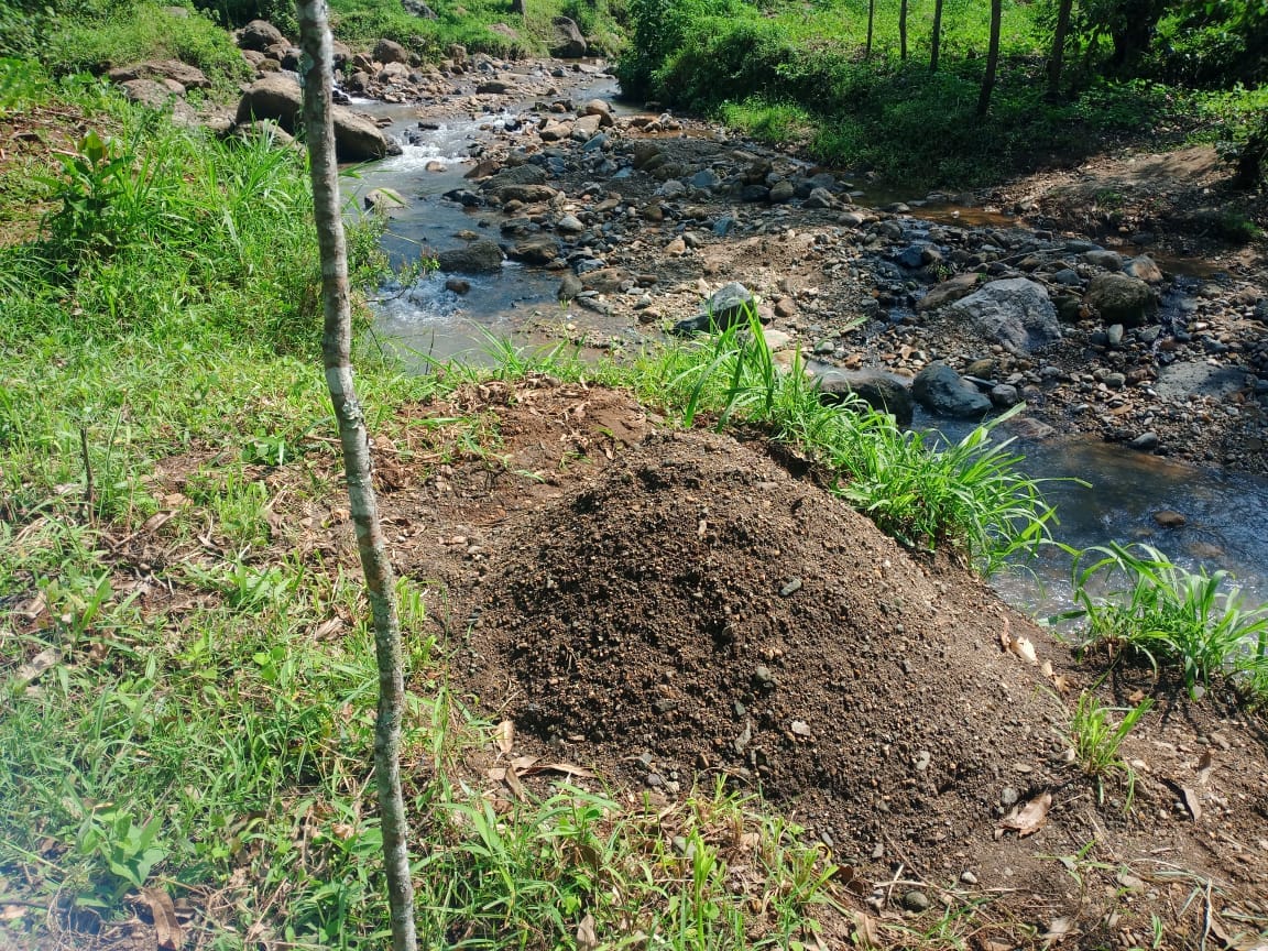
Technologies farmers are using now
Whichever question brought you here, there's a page for it
Farmers & extension
Practical technologies, field examples and training contacts.
Researchers & students
Data, methods, zone profiles and collaboration routes.
Policy & district planners
Evidence, priority areas and investment implications.
Partners & NGOs
Geographic coverage, results and partnership models.
Private sector
Service opportunities in soil, advisory and restoration work.
Media & public
A plain-language explanation of SLM and why it matters.
Want to work with the SLM team?
Technical support, training, data requests, research partnerships and field demonstrations — find the right route in.


